Private, fixed-price transfers from Malta Airport to Valletta, the hotel districts and Gozo — plus what to see and how to get around once you arrive.
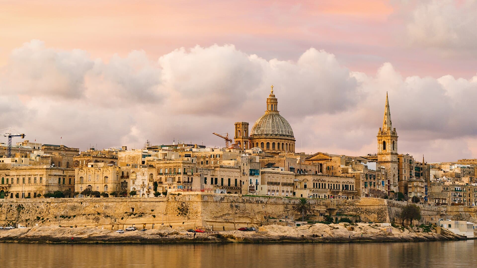
Malta International Airport sits at Luqa, near the middle of the main island and about 5 km south-west of Valletta, which is why almost nowhere on Malta is far from it. The capital occupies a narrow peninsula between the Grand Harbour and Marsamxett Harbour, with the Three Cities facing it across the water. The hotel districts of Sliema and St Julian’s run north-east along the coast, and the resort towns carry on past St Paul’s Bay and Buġibba to Mellieħa and the northern tip.
What changes a journey on these islands is not distance but water. Gozo lies beyond the Ċirkewwa–Mġarr crossing, and Comino sits between the two, with the Blue Lagoon in the channel between it and the islet of Cominotto. On the main island the sights are close together: Valletta is a UNESCO World Heritage Site with 320 monuments inside half a square kilometre, the walled city of Mdina stands inland on its plateau, and Marsaxlokk still keeps its fishing fleet and its Sunday market on the south-east coast. On Gozo, the temples of Ġgantija are older than the pyramids of Egypt.
City centre, 5 km from the airport
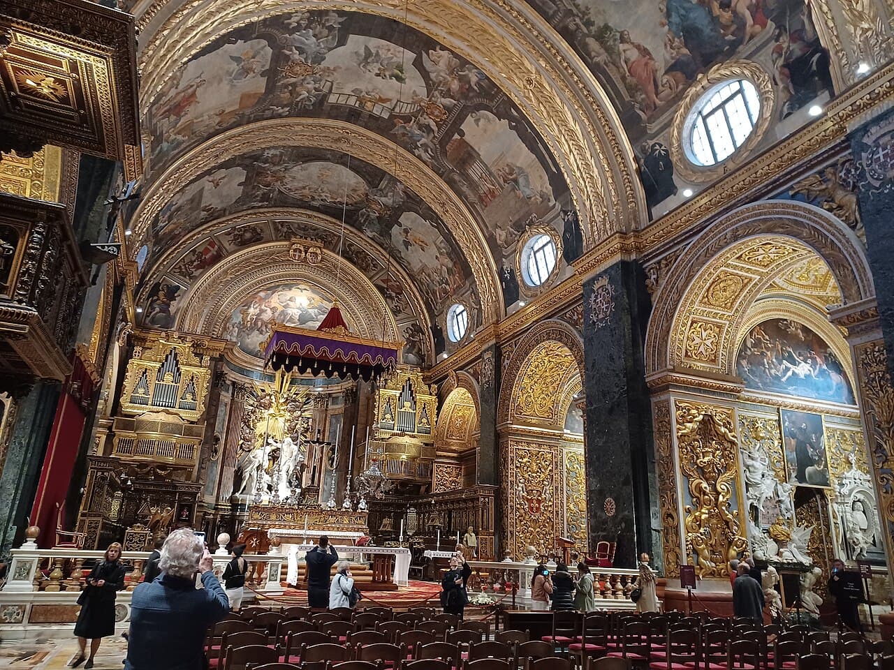
Valletta was begun in 1566, when Grand Master Jean de Valette laid the foundation stone of a fortified city after the Great Siege, and it carries his name. The city has been a UNESCO World Heritage Site since 1980, with 320 monuments inside 0.55 square kilometres. Its centrepiece is St John’s Co-Cathedral, built between 1573 and 1578: an austere, fortress-like exterior hides an interior redecorated by Mattia Preti in the 1660s, a floor of some 400 knights’ tombs, and Caravaggio’s Beheading of Saint John the Baptist in the oratory.
Western Malta, inland on its plateau
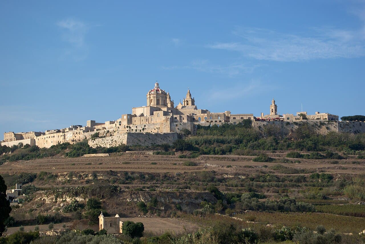
Mdina was the capital of Malta from antiquity until 1530, when the Order of St John arrived and settled at Birgu instead. The city has never spread beyond its walls and had a population of 242 in July 2024 — which is how it came by its nickname, the Silent City: no cars are allowed inside apart from a limited number of residents’ and emergency vehicles, wedding cars and horses. About 1.5 million visitors a year walk in through the gate rebuilt under Grand Master Vilhena from 1722.
South-east coast
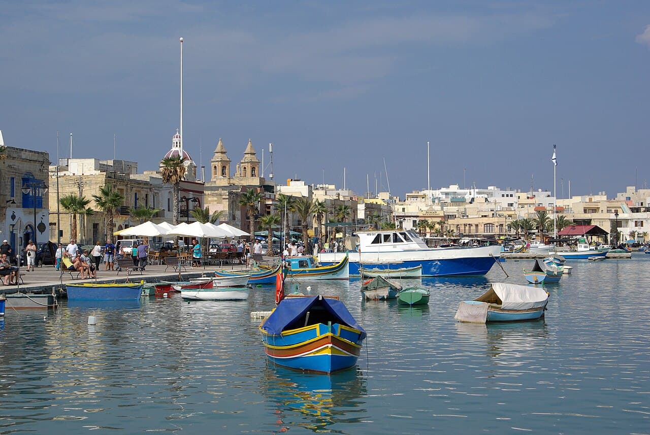
Marsaxlokk is a fishing village on a sheltered bay in the south-east, its inner harbour lined with traditional luzzi. About 70% of the Maltese fishing fleet is based here. On weekdays the catch goes to the fish market in Marsa, but on Sundays the fishermen sell it straight from the quay, alongside the large market that runs along the seafront. The name says where it is: marsa is Arabic for port, and xlokk is Maltese for south-east.
Comino, between Malta and Gozo
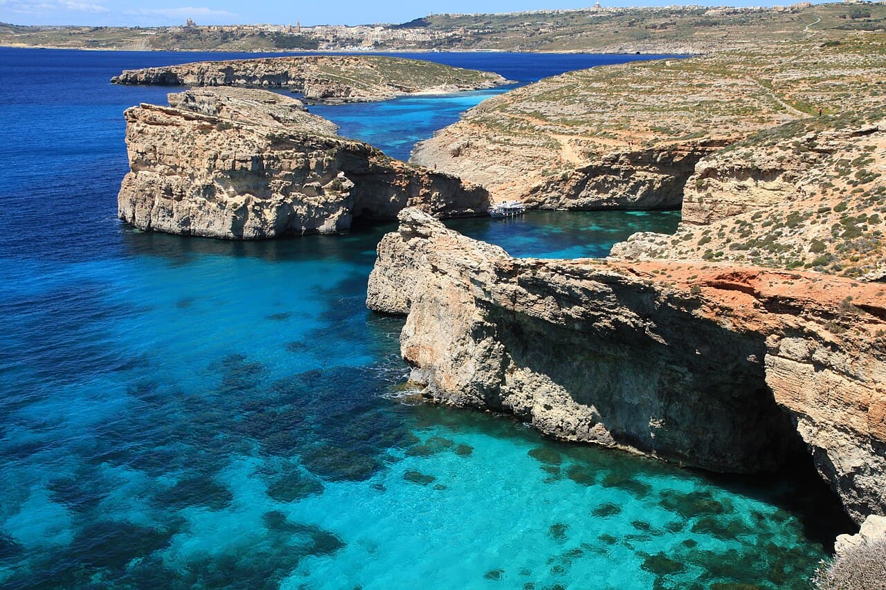
Comino lies between Malta and Gozo, measures 3.5 square kilometres and has a permanent population of two. The island is a bird sanctuary and nature reserve, and what draws the boats is the Blue Lagoon: the channel between Comino and the islet of Cominotto, where transparent cyan water lies over a white sandy bed. It is popular with swimmers, snorkellers and divers. Scheduled boats run from Ċirkewwa on Malta and Mġarr on Gozo, and schedules vary by season.
Xagħra, Gozo
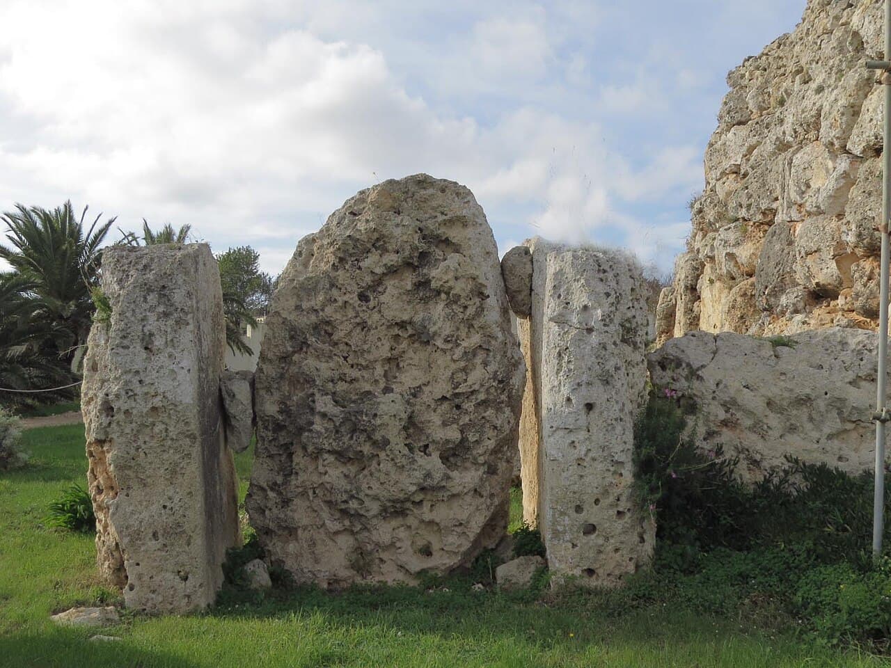
The temples at the edge of the Xagħra plateau on Gozo are the earliest of the Megalithic Temples of Malta and older than the pyramids of Egypt: their makers raised them in the Neolithic, which makes them more than 5,500 years old. The southern temple is the larger and older of the two, dating from around 3600 BC, rising to a height of 6 metres and taking in five large apses. The name means “place of giants”, and the site has been a UNESCO World Heritage Site since 1980.
Prices start from the lowest published fare for this airport and depend on the destination and vehicle class. Cancel up to 24 hours before pickup for a 90% refund.
Photo credits Olga Prystai (CC BY-SA 4.0) · Simon Burchell (CC BY-SA 4.0) · Berthold Werner (CC BY-SA 3.0) · Berthold Werner (CC BY-SA 3.0) · Frank Vincentz (CC BY-SA 3.0) · BrandyMay (CC BY-SA 4.0)